radiological · Erie County
Seaway FUSRAP Site / Tonawanda North Unit 3
Town of Tonawanda
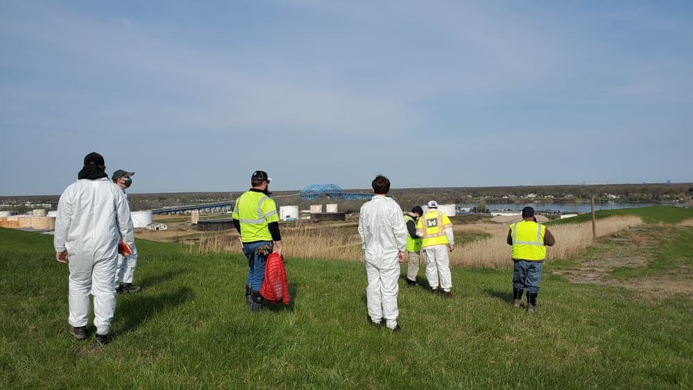
River Road landfill areas containing material moved from the former Ashland property, where residues from Linde uranium processing had been stored.
The documented story
What happened here?
The Seaway Site lies within a roughly 100-acre industrial park and former landfill along River Road. The landfill accepted municipal, commercial, construction, and industrial wastes, and in 1974 it also received material moved from the nearby Ashland 1 property that contained residues from Linde's wartime uranium-processing work.
FUSRAP addresses the radiological portion of this mixed landfill history. The contaminants associated with that program include radium, thorium, uranium, and uranium daughter products; other landfill materials remain subject to their own regulatory history.
Connected history - Ashland soil became a landfill layer
Seaway contains the far end of Tonawanda's wartime material chain
22 acresapproximately, covered by the engineered radiological cap
1940s-1974
The site's atomic connection began somewhere else
Linde residues were stored at Ashland 1 in the 1940s. When Ashland Oil excavated there in 1974, part of the mixed soil and residue was taken to the Seaway landfill, adding a radiological layer to an existing industrial-disposal landscape.
1993-2009
A closed landfill prompted a long remedy debate
Landfill disposal ended in 1993 and part of the property was capped. DOE suspended an earlier cleanup proposal in 1994 after community concern; the Army Corps ultimately selected containment with limited off-site disposal in a 2009 decision.
2016-2025
Excavation and a five-foot engineered cap completed the selected construction
North-side excavation was completed in 2016. The approximately 22-acre, roughly five-foot-thick engineered cap was installed in 2024, and the Army Corps reported remedy construction complete in December 2025.
Manhattan Project-derived material: later disposal of residues moved from the Ashland property
News record
Major news events
Coverage selected here marks a turning point in public awareness, policy, enforcement, employment, or cleanup. Links open at the original publisher or archive; WNYAtlas does not reproduce restricted articles or images.
Ashland excavation moves uranium-processing residues into the Seaway landfill
Material originating with Linde's wartime uranium work was mixed with soil at Ashland 1 and transported to Seaway, giving an ordinary mixed-waste landfill a second federal radiological history.
U.S. Army Corps of Engineers project record ↗Federal remedy contains the radiological material beneath an engineered cap
The selected remedy consolidated and covered the defined FUSRAP material while preserving inspection, monitoring, and five-year review obligations.
U.S. Army Corps of Engineers ↗Chemical guide
Chemicals named in this record
These links explain potential hazards and exposure pathways. A chemical named in a record does not establish that anyone was exposed or harmed.
Chronology
Timeline
- 1930–1993
The property operated as a landfill accepting multiple categories of non-FUSRAP waste.
- 1974
Material containing Linde-derived residues was moved from Ashland 1 and placed at Seaway.
- 2009
USACE selected containment with limited off-site disposal as the FUSRAP remedy.
- 2015–2016
USACE excavated and shipped 1,121 cubic yards of qualifying FUSRAP material from the Northside area for off-site disposal.
- 2024–2025
An engineered cap was installed over Areas A, B, and C and completed in December 2025.
Environmental record
Documented impacts
- FUSRAP-related soil contains radium, thorium, uranium, and associated daughter products derived from the region's early atomic-energy work.
- The radiological material is embedded within a larger former landfill that accepted varied municipal and industrial wastes.
- The remedy distinguishes capped landfill areas from Northside and Southside material outside the landfill boundaries.
Response
Cleanup and controls
- A roughly 22-acre, multilayer engineered cap—at least about 4.5 feet thick—contains FUSRAP material in Areas A, B, and C.
- Qualifying material outside the landfill containment boundary is excavated for licensed off-site disposal under the selected remedy.
- Federal surveillance, maintenance, long-term monitoring, land-use controls, and recurring five-year reviews are required because material remains contained on site.
Then and now
The site today
The engineered cap was completed in December 2025, with final establishment work continuing in 2026. USACE is conducting the next five-year review, scheduled for completion in 2027; the completed cap begins a long-term stewardship phase rather than ending federal responsibility.
Atlas connections
Connected places
These collections explain documented material, facility, waterway, ownership, or cleanup relationships. Inclusion does not imply that every place shares one contaminant source or plume.
Tonawanda FUSRAP material network
Uranium-processing residues and related material moved among industrial properties, storage areas, landfills, and vicinity properties in the Town of Tonawanda.
Linde processed uranium ores for the Manhattan Engineer District, creating residues later addressed at multiple Tonawanda properties.
Interim storage propertyAshland 1 / Former Ashland Oil RefineryThe former refinery property received Linde-related residues before portions of the material were moved again.
Related cleanup propertyAshland 2 FUSRAP SiteAshland 2 forms part of the federal Tonawanda FUSRAP cleanup record and its connected material history.
Landfill containment siteSeaway FUSRAP Site / Tonawanda North Unit 3Material moved from Ashland 1 in 1974 became part of the radiological remedy at the Seaway landfill.
Vicinity propertyTonawanda Landfill FUSRAP Vicinity PropertyThe landfill vicinity record tracks qualifying material outside the principal federal cleanup boundaries.
Related disposal propertyNiagara Mohawk–Cherry FarmCherry Farm belongs to the broader Tonawanda record of industrial disposal and radiological investigation.
River Road industrial and disposal corridor
Coke, plastics, steel, landfills, and material-transfer histories overlap along River Road. These records are geographically related but retain separate cleanup boundaries and responsible-party histories.
The former coke plant anchors the corridor's heavy-industrial and air-emissions history.
Plastics propertyTonawanda PlasticsThe plastics site is a separately regulated industrial property within the same River Road landscape.
Steel propertyRoblin Steel — TonawandaThis Tonawanda steel site is distinct from the former Roblin Steel cleanup in Dunkirk.
Chemical tank-truck terminalChemical Leaman Tank LinesChemical Leaman adds chemical transport, tank cleaning, and a managed environmental easement to the corridor.
Upland and sediment cleanup5565 River RoadThe 5565 River Road record connects a Class 2 upland site with separately mapped PCB-affected sediment.
Industrial landfillNiagara Mohawk–Cherry FarmCherry Farm connects the corridor's manufacturing history to documented disposal and long-term containment.
Mixed landfill and FUSRAP siteSeaway FUSRAP Site / Tonawanda North Unit 3Seaway adds municipal, industrial, and radiological material histories to the corridor.
Radiological-map connection
Place this site in the wider material history
The separate radiological investigation map distinguishes producers, processors, storage, the 100 historical survey records, federal remediation, and current assessment coverage.
Linked research mapOpen the radiological investigation →