radiological · Erie County
Tonawanda Landfill FUSRAP Vicinity Property
Town of Tonawanda
Town landfill and mudflats vicinity property where radioactive material resembled material at other FUSRAP sites, although no record ties the property to Manhattan Engineer District or Atomic Energy Commission operations.
The documented story
What happened here?
The Town of Tonawanda operated this municipal landfill from the 1930s until 1989, accepting incinerator ash, sewage sludge, construction debris, and household and yard waste. In 1992, the Department of Energy designated portions of the landfill and adjacent mudflats as a FUSRAP vicinity property after finding radioactive material that resembled material at other Tonawanda FUSRAP sites. That resemblance is not a proven chain of custody: federal agencies say no record has been found showing that this property took part in Manhattan Engineer District or Atomic Energy Commission work.
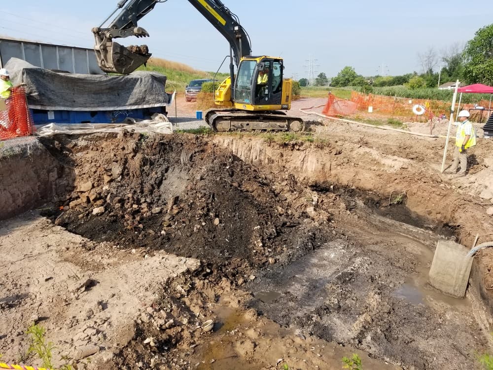
USACE divided the property into two operable units because the evidence and remedies were different. The mudflats—now part of the North Youngmann Commerce Center—received a 2008 no-action decision. At the landfill, workers used field instruments and laboratory analysis to guide a targeted removal of shallow radioactive soil and debris. The work dealt with accessible contamination while leaving radioactive material below five feet under a commercial-industrial land-use standard.
A later and separately sourced radiological history also reached the broader landfill property. Federal records trace americium-241 released by EAD Metallurgy to the Town sanitary sewer, sewage-treatment sludge, the municipal sludge incinerator and identified areas of the eastern landfill. This 1977-1983-era EAD pathway is not the source of the older Linde/FUSRAP uranium, radium and thorium record.
Similarity triggered federal action; origin remained unproven
Tonawanda Landfill entered FUSRAP without a documented atomic-program disposal record
>5 feetdepth below which some residual material remains under controls
1992
Material similarity, not a disposal receipt, drove designation
DOE combined a portion of the former Town landfill and the mudflats area, now associated with the North Youngmann Commerce Center, into one vicinity property after surveys found radioactive material similar to other FUSRAP locations.
Two operating units
The landfill and mudflats reached different decisions
The Mudflats Operable Unit required no remedial action and no continuing monitoring. The Landfill Operable Unit received a response designed for commercial, industrial, and recreational use rather than unrestricted residential use.
Long-term stewardship
Deep residual material remains part of the land-use record
Radium, uranium, and thorium remain above unrestricted-use levels below five feet in controlled areas. The remedy uses land restrictions and five-year review, with federal stewardship evaluated over a 1,000-year horizon.
FUSRAP — origin unconfirmed: radiological vicinity property; no documented MED/AEC activity
News record
Major news events
Coverage selected here marks a turning point in public awareness, policy, enforcement, employment, or cleanup. Links open at the original publisher or archive; WNYAtlas does not reproduce restricted articles or images.
Targeted removal closes the shallow-cleanup phase
Federal crews excavated radiologically contaminated soil to five feet, completed remedial action in 2020, and documented closure in 2022 while deeper material remained subject to long-term review.
U.S. Army Corps of Engineers ↗Chemical guide
Chemicals named in this record
These links explain potential hazards and exposure pathways. A chemical named in a record does not establish that anyone was exposed or harmed.
Chronology
Timeline
- 1977-1983 operation; investigation through 1988
EAD's smoke-detector-foil operation released americium-241 to the sanitary sewer; subsequent investigation traced it through treatment sludge and incinerator ash to identified eastern-landfill areas, with 1988 characterization reporting Am-241 as deep as seven feet in those areas.
- 1992
DOE designated the landfill and mudflats as a FUSRAP vicinity property.
- Federal investigation
USACE evaluated the landfill and mudflats as separate operable units and found no documentary MED/AEC link.
- 2017
The landfill Record of Decision selected a commercial-industrial remedy; the mudflats required no action.
- 2019–2022
Targeted excavation removed shallow radioactive soil and debris; remedial action finished in 2020 and USACE issued the site closeout report in 2022.
- Long-term stewardship
Because radium, uranium, and thorium remain below five feet, the landfill remedy requires periodic inspections and statutory five-year reviews rather than unrestricted release.
Environmental record
Documented impacts
- Radium, uranium, and thorium contamination was identified in landfill materials.
- Residual radioactive material remains below approximately five feet in portions of the landfill.
- The evidence supports a FUSRAP vicinity-property designation but not a claim that MED or AEC production occurred here.
- Americium-241 associated with EAD was investigated in separately identified landfill areas. Its source, isotope and municipal-waste route must not be merged with the FUSRAP material.
Response
Cleanup and controls
- USACE reported excavating 4,345 cubic yards of shallow radioactive-contaminated soil to a depth of five feet. DOE's stewardship account says 3,476 cubic yards—about 5,000 tons—of radiological soil and debris were shipped by rail to a licensed disposal cell in Belleville, Michigan; the different figures describe excavation and shipped waste, not necessarily the same measurement.
- The remedy is considered protective for recreational use but does not establish unrestricted residential suitability.
- No active operation-and-maintenance system is needed for the remedy to function, but periodic inspections and five-year reviews are required because material remains at depth. DOE's long-term stewardship plan covers a 1,000-year performance period.
Then and now
The site today
The landfill response is complete, with deeper residual contamination managed through land-use assumptions and long-term review. The adjacent mudflats received a no-action decision and should not be mapped as though they share the landfill's residual-contamination finding.
Atlas connections
Connected places
These collections explain documented material, facility, waterway, ownership, or cleanup relationships. Inclusion does not imply that every place shares one contaminant source or plume.
Tonawanda FUSRAP material network
Uranium-processing residues and related material moved among industrial properties, storage areas, landfills, and vicinity properties in the Town of Tonawanda.
Linde processed uranium ores for the Manhattan Engineer District, creating residues later addressed at multiple Tonawanda properties.
Interim storage propertyAshland 1 / Former Ashland Oil RefineryThe former refinery property received Linde-related residues before portions of the material were moved again.
Related cleanup propertyAshland 2 FUSRAP SiteAshland 2 forms part of the federal Tonawanda FUSRAP cleanup record and its connected material history.
Landfill containment siteSeaway FUSRAP Site / Tonawanda North Unit 3Material moved from Ashland 1 in 1974 became part of the radiological remedy at the Seaway landfill.
Vicinity propertyTonawanda Landfill FUSRAP Vicinity PropertyThe landfill vicinity record tracks qualifying material outside the principal federal cleanup boundaries.
Related disposal propertyNiagara Mohawk–Cherry FarmCherry Farm belongs to the broader Tonawanda record of industrial disposal and radiological investigation.
Radiological-map connection
Place this site in the wider material history
The separate radiological investigation map distinguishes producers, processors, storage, the 100 historical survey records, federal remediation, and current assessment coverage.
Linked research mapOpen the radiological investigation →