radiological · Niagara County
Niagara Falls Storage Site Vicinity Properties
Lewiston and Porter
Properties surrounding the federal storage site that have been investigated or remediated individually for material associated with the Niagara Falls Storage Site.
The documented story
What happened here?
Niagara Falls Storage Site vicinity properties are parcels outside the principal federal site that were investigated because Manhattan Engineer District or Atomic Energy Commission material may have been moved, deposited, or dispersed there. They are not one continuous contamination zone and must be evaluated parcel by parcel.
USACE identifies several open parcels north of NFSS on private property, including VP-E, E-Prime, H-Prime, and G, plus the town-owned VP-X. Access, historical use, sampling results, and remedy status differ across these locations.
The federal project history also records numerous vicinity properties where work was completed during the 1980s and parcels where investigation found that remedial action was not required. The 2025 proposal for VP-H-Prime illustrates the continuing parcel-by-parcel process: USACE completed a remedial investigation for the four-acre property and proposed no remedial action, subject to public review and a final decision. A vicinity-property label therefore describes an investigation history, not one uniform present condition.
The federal boundary did not contain every historical movement of material
NFSS vicinity properties are a parcel-by-parcel program, not one contamination ring
Parcel by parcelthe required unit of investigation and decision
1940s-1950s
Federal handling created possible pathways beyond the storage property
Wartime and early atomic-era storage, movement, and disposal created reasons to survey neighboring lands. Historical association triggered investigation but did not establish uniform contamination.
DOE and USACE program
Individual properties were surveyed, cleaned, closed, or kept open
Federal teams assigned vicinity-property identifiers and made separate decisions for each. Some properties were remediated, some met criteria, and others remain open because investigation or access is incomplete.
2025-present
New decisions continue to refine the map
USACE proposed no remedial action for the four-acre VP-H-Prime parcel after its investigation. Other parcels remain subject to federal review, access coordination, funding, and property-specific decisions.
Manhattan Project-derived material: vicinity-property investigation and cleanup
Chronology
Timeline
- 1940s–1950s
Federal storage and handling at the former ordnance works created pathways by which affected material reached some neighboring parcels.
- DOE and USACE investigations
Individual vicinity properties were surveyed, remediated, closed, or retained for further investigation.
- September 2025
USACE released a remedial-investigation report and proposed no remedial action for the four-acre VP-H-Prime parcel.
- Current program
USACE remains responsible for investigation and response at open vicinity properties when access and funding allow.
Environmental record
Documented impacts
- Some vicinity properties were affected by material associated with MED/AEC operations at the Niagara Falls Storage Site.
- Other investigated parcels may meet cleanup criteria or receive a no-action determination; the designation alone does not prove current contamination.
- Private ownership and limited access have delayed investigation of certain parcels.
Response
Cleanup and controls
- Each parcel receives its own investigation, decision, verification, and closeout rather than a single area-wide remedy.
- Completed removals and no-action determinations must be tied to the exact vicinity-property identifier and boundary.
- Open parcels remain subject to federal investigation, access coordination, and any remedy selected from their sampling results.
Then and now
The site today
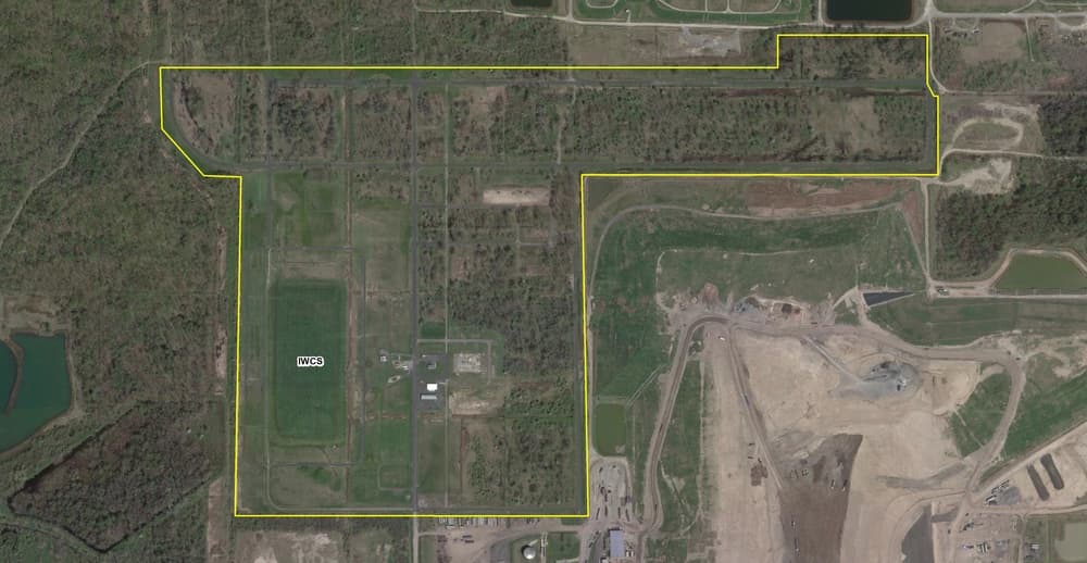
The vicinity-property program remains partly open. The map point is an orientation marker, not a claim that every surrounding parcel is contaminated; future polygon mapping should show each federal parcel and its individual status.
Atlas connections
Connected places
These collections explain documented material, facility, waterway, ownership, or cleanup relationships. Inclusion does not imply that every place shares one contaminant source or plume.
Niagara regional radiological record
Federal storage, industrial processing, vicinity-property cleanup, and later residential or public-property investigations form a connected regional research record.
The storage site is the principal federal property in a wider network of material handling, containment, and vicinity-property work.
Vicinity propertiesNiagara Falls Storage Site Vicinity PropertiesThese properties are managed separately where eligible material lies beyond the principal storage-site boundary.
Wartime industrial facilityElectro Metallurgical CompanyElectro Metallurgical represents a separate Manhattan Project-era industrial operation within the Niagara record.
Investigated propertyNiagara Falls Boulevard Radiation SiteThis location was identified through later radiological investigation rather than treated as part of the NFSS parcel itself.
Public-property responseDonovan Head Start Slag RemovalThe Head Start response documents investigation and removal at a public-use property.
Investigated propertyUpper Mountain Road Radiation SiteUpper Mountain Road is one of several separately bounded locations in the regional assessment record.
Vicinity investigationHoly Trinity Cemetery VicinityThe cemetery vicinity record is linked by regional radiological assessment, not by a claim that every property shares one source.
Regional assessmentNiagara–Erie Residential Radiological AssessmentThe assessment provides the umbrella research context for evaluating multiple residential and public locations.
Radiological-map connection
Place this site in the wider material history
The separate radiological investigation map distinguishes producers, processors, storage, the 100 historical survey records, federal remediation, and current assessment coverage.
Linked research mapOpen the radiological investigation →