waterway · Erie County
Katherine Street Peninsula
Buffalo
Former industrial Buffalo River peninsula with compacted fill and a documented waste-oil handling history nearby, where contaminated river sediment was addressed and multiple shoreline and habitat-restoration projects were completed. Sources reviewed do not establish the peninsula as a former municipal landfill.
The documented story
What happened here?
Katherine Street Peninsula is a filled industrial landform in the Buffalo River corridor. Historical mapping and planning records show compacted fill and nearby waste-oil handling, while the river edge was affected by the broader legacy of contaminated Buffalo River sediment.
EPA, USACE, and local partners combined sediment remediation with shoreline and habitat restoration here. The reviewed sources do not establish that the peninsula itself was a municipal landfill, so the atlas avoids repeating that unverified description.
An industrial peninsula became a rebuilt river edge
Katherine Street tells a restoration story without inventing a landfill
1,190 feetshoreline habitat restored in the 2015 project
Industrial era
Fill and hard use simplified a once-complex shoreline
Industrial occupancy, compacted fill, hardened banks, and nearby waste-oil handling altered the river edge. Those documented conditions provide the setting without assigning every nearby activity or contaminant to the peninsula itself.
2015
The first major project rebuilt fish habitat
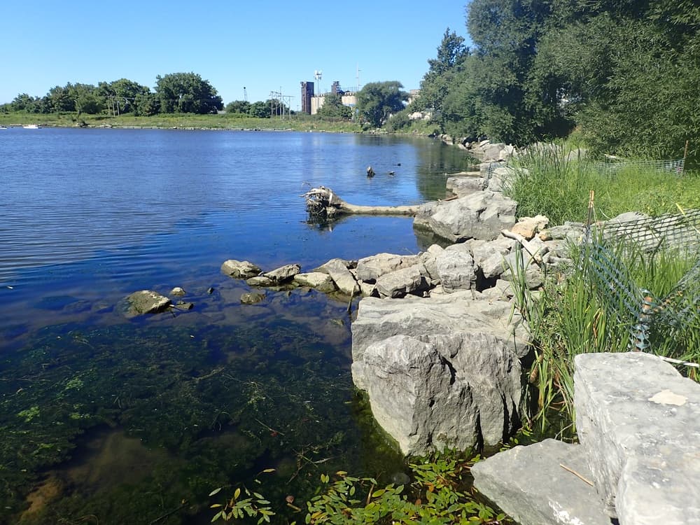
A Buffalo River Area of Concern project restored approximately 1,190 linear feet of shoreline habitat, replacing a degraded edge with features designed for fish, wildlife, and native vegetation.
2018 and after
Restoration expanded around the peninsula
Additional work treated about 1,760 feet of northeast shoreline and 3.7 acres, a 2.4-acre toe area, and a roughly 450-foot extension with another 3.7 acres. The projects form a connected habitat system within the remediated river corridor.
Chronology
Timeline
- Industrial era
Filling and industrial waterfront use reshaped the peninsula and its shoreline.
- Buffalo River cleanup
Contaminated navigation-channel and river sediment was addressed through the Area of Concern program.
- Restoration phase
Partners rebuilt shoreline and shallow-water habitat at Katherine Street.
- 2024
USACE announced completion of the Katherine Street habitat-restoration work.
Environmental record
Documented impacts
- Industrial fill and former waterfront uses altered the natural shoreline and subsurface.
- Contaminated Buffalo River sediment affected aquatic habitat along the peninsula.
- Available primary records support a waste-oil history nearby but not a claim that the landform was a municipal dump.
Response
Cleanup and controls
- River sediment remediation reduced direct contaminant sources in the Area of Concern.
- Shoreline grading, native vegetation, and aquatic habitat features restored ecological function.
- Future soil disturbance should be guided by parcel-specific environmental investigation of historic fill.
Then and now
The site today
The peninsula is best understood as a restored industrial shoreline within a remediated river corridor. Its exact upland fill history remains less certain than the documented sediment and habitat work.
Atlas connections
Connected places
These collections explain documented material, facility, waterway, ownership, or cleanup relationships. Inclusion does not imply that every place shares one contaminant source or plume.
Buffalo River industrial corridor
Industrial parcels, former disposal areas, sediment remedies, and restored habitats form a shared river corridor while retaining separate ownership and cleanup records.
The river is the organizing environmental system for this collection.
Chemical-manufacturing shorelineBuffalo ColorBuffalo Color represents a major industrial parcel with documented sewer and shoreline pathways.
Steel and coke landscapeRepublic SteelThe former Republic Steel landscape links heavy industry, managed brownfields, and riverfront redevelopment.
Former industrial propertyIroquois Gas / Westwood PharmaceuticalThis property adds a distinct industrial and cleanup history within the broader river corridor.
Peninsula cleanup areaKatherine Street PeninsulaThe peninsula record connects upland contamination, shoreline conditions, and river restoration.
Landfill and steel propertyAlltift Landfill / Ramco SteelAlltift links filled industrial land to the river corridor's disposal history.
Recovered landscapeTifft Nature PreserveTifft shows the corridor's transition from industrial and filled land to habitat and public use.
Confined-disposal and habitat siteTimes Beach Confined Disposal SiteTimes Beach connects dredged-material management with later habitat value.
Research status
Open questions
- Locate parcel-level boring logs and waste-oil facility records before assigning a stronger upland contamination status.
- Keep completed river restoration distinct from any future upland redevelopment cleanup.