cleanup · Erie County
1660 Niagara Street Shoreline
Buffalo
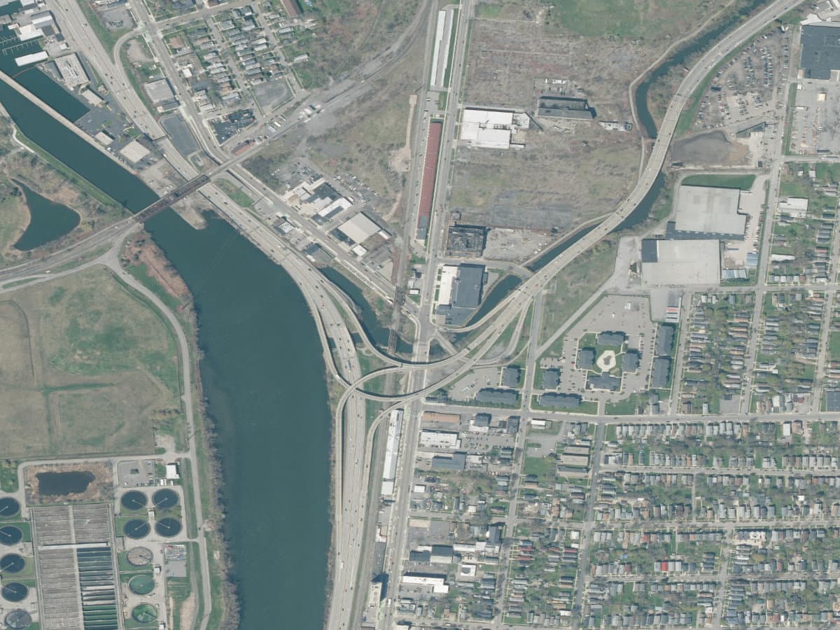
Niagara River shoreline sediment area associated with the 1660 Niagara Street cleanup record. DEC identifies PCB-affected sediment here; the marker represents the documented sediment boundary and should not be generalized to the entire upper Niagara River shoreline.
The documented story
What happened here?
The 1660 Niagara Street record represents a specific industrial shoreline property and associated Niagara River sediment area, not the entire West Side waterfront. The location developed within a corridor shaped by manufacturing, bulk handling, rail access, filling, and repeated property reuse.
DEC identifies PCB-affected sediment adjoining the cleanup property. That connection makes the shoreline an important example of how upland industrial activity and submerged environmental records must be researched together.
The state record and mapped sediment layer serve different but complementary purposes. The remediation file documents decisions and work associated with the upland brownfield, while the GIS feature preserves the location of the affected shoreline sediment. Keeping those scopes separate prevents completion of a park or upland construction phase from being mistaken for proof that every submerged sediment obligation is also complete.
The environmental record continues below the waterline
At 1660 Niagara Street, the shoreline sediment is a feature of its own
2 settingsupland property and adjoining submerged sediment
Industrial waterfront era
Manufacturing and fill hardened the Niagara Street edge
Successive industrial and material-handling uses occupied a shoreline built for rail and water access. Historic fill and repeated reuse created an upland record that cannot be understood from the present streetscape alone.
Investigation
Sampling extended from land into the Niagara River
Environmental work evaluated the parcel and adjoining sediment. DEC's sediment inventory identifies PCBs in a defined shoreline feature rather than labeling the whole upper Niagara River waterfront.
Present redevelopment
Public access and environmental controls share the same shoreline
The Niagara Street corridor is changing rapidly. Construction, dredging, or sediment disturbance must account for the mapped feature even as surrounding land gains new uses and waterfront access.
News record
Major news events
Coverage selected here marks a turning point in public awareness, policy, enforcement, employment, or cleanup. Links open at the original publisher or archive; WNYAtlas does not reproduce restricted articles or images.
A planned waterfront park is delayed when industrial contamination complicates construction
Local reporting connected the public-access project to petroleum, PCB, metals, VOC, urban-fill, and shoreline-sediment questions that required phased investigation before redevelopment could proceed.
Spectrum News ↗A Black Rock shoreline parcel becomes both a brownfield and a river-sediment project
The land cleanup and PCB-affected shoreline sediment are related but distinct scopes; park construction does not by itself establish that the adjoining aquatic remedy is complete.
New York State Department of Environmental Conservation ↗Chemical guide
Chemicals named in this record
These links explain potential hazards and exposure pathways. A chemical named in a record does not establish that anyone was exposed or harmed.
Chronology
Timeline
- Industrial waterfront era
Manufacturing and material-handling uses developed along the Niagara Street shoreline.
- Investigation
Environmental work evaluated the upland parcel and adjoining river sediment.
- State cleanup record
DEC established a site-specific remedial record for the property and associated sediment.
- Present
PCB-affected sediment remains mapped as a bounded feature requiring careful interpretation and management.
Environmental record
Documented impacts
- DEC's sediment inventory identifies PCBs in a defined shoreline sediment area.
- Historic fill and industrial use make the upland-to-river pathway important to the site interpretation.
- The available boundary does not support describing the entire upper Niagara River shoreline as affected by this site.
Response
Cleanup and controls
- Investigation and remedial decisions distinguish upland soil or groundwater from submerged sediment.
- Any shoreline construction, dredging, or sediment disturbance must account for the documented affected area.
- The atlas uses the mapped sediment feature rather than extending the marker to unrelated waterfront parcels.
Then and now
The site today
The site remains part of a rapidly changing Niagara Street waterfront. Redevelopment and public access should be described alongside, not in place of, the documented sediment record and any continuing controls.
Atlas connections
Connected places
These collections explain documented material, facility, waterway, ownership, or cleanup relationships. Inclusion does not imply that every place shares one contaminant source or plume.
Western New York sediment controls
These sites contain documented sediment remedies or affected sediment areas. They are a comparative research collection, not evidence of a shared source or connected plume.
A geotextile and stone cover isolates PAHs, PCBs, and metals in part of the former industrial canal.
Chlorinated-solvent sediment coverWeber-Knapp CompanyDEC records a clean-stone cover at this Jamestown manufacturing cleanup.
PCB-affected sediment areaTennessee Gas Pipeline Station 229The Eden compressor-station record extends sediment concerns into a rural drainage setting.
PCB-affected shoreline sediment5565 River RoadThe River Road entry connects an upland Class 2 site with Niagara River-edge sediment.
PCB-affected shoreline sediment1660 Niagara Street ShorelineThe Niagara Street marker represents a bounded sediment record rather than the entire river shoreline.
Dioxin- and furan-affected sedimentDurez / Occidental ChemicalThe Durez record adds a distinct chemical-manufacturing and sediment-contaminant history.
Riprap and habitat coverGratwick Riverside ParkGratwick combines landfill containment, shoreline protection, and present-day park use.